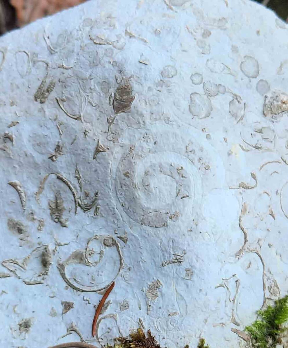
> The Limestone Formation of Monte Cavallo <
Reef complex at Col dei S’cios
Limestone n.
Limestone is a sedimentary rock of chemical or organogenic origin, composed primarily of calcium carbonate (CaCO₃) in the form of calcite or aragonite.
Col dei S’cios geo-palaeontological trail
GPS track Divulgando Srl, recorded on 6 April 2023 · The guide gives a loop of about 6 km with 250 m of ascent; the values above are calculated from the GPS track. Estimated time: 4 km/h plus 1 hour per 400 m of ascent, excluding stops.
The carbonate platform: where the rudists lived
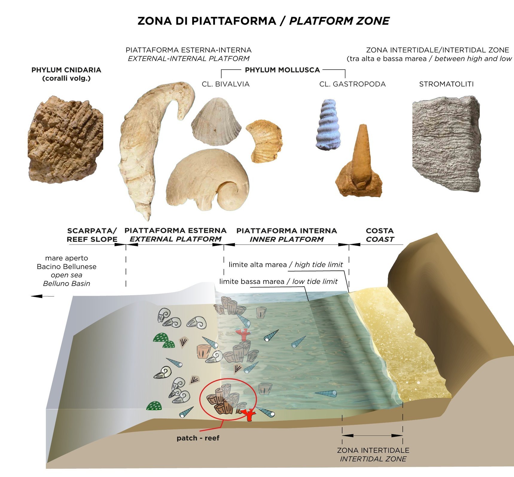
Between 160 and 65 million years ago the Cansiglio–Cavallo area was the Friulian Platform: a warm, shallow sea at tropical latitudes, with landscapes similar to today’s Bahamas.
The drawing shows its zones, from the slope that slopes down towards the open sea of the Belluno Basin as far as the coast. On the outer and inner platform lived corals, bivalves – including rudists – and gastropods, with small isolated reefs (patch-reef); in the intertidal zone, between high and low tide, grew the stromatolites.
The Col dei S’cios Limestone preserves one of the phases of greatest development of rudist bioconstructions, in the Early to Middle Cenomanian (100–95 million years ago).
Drawing by Barbara Buttignol · from the panel «The Monte Cavallo Limestone Formation» · Municipality of Polcenigo, project by Divulgando Srl
Videos and documentaries
Video stories and mini documentaries about the geosite’s places.
Explore
Sheet, audio guide and immersive environment for each place.
> The Col dei S’cios <
The Col dei S’cios (or Schiosi) is a site of significant geological interest, so much so that it is recognised and protected as a Geosite by the Friuli Venezia Giulia Region.
This spot has been appreciated by researchers for centuries for its palaeontological and geological peculiarities, in particular, the rudist fossil outcrops (the Formation of the Limestone of Monte Cavallo), which characterise the southern part of the ridge of Monte Candaglia, are worth highlighting.
Among the pioneers of palaeontological studies of the site, the name of Dr. Giulio Andrea Pirona stands out and who, in an essay from 1882, wrote: “the place is called Col dei Schiosi (lit. “hill of the snails”), due to the large quantity of fossil remains, especially gastropods, of which those rocks, corroded and, I would almost say, damaged - by weathering, are filled, and which sometimes, free from any adhesion, lie scattered on the ground”. In a few lines Pirona illustrates the extraordinary fossiliferous richness of the Col dei S’cios, an observation subsequently supported by other researchers of the time.
It is important to underline that many of the finds Pirona discovered back then have been removed over time, both for scientific research and museum display, and for purposes not always intended for the community.
In this context, it therefore seems essential to promote the importance of protecting and preserving the fossil evidence remaining on site. The Col dei S’cios is not only distinguished by its palaeontological value, but also by its geological characteristics. The “rocks corroded… and damaged by weathering” offer a typical scenario of karst areas shaped over time by the persistent action of water. The zone is riddled by a large number of sinkholes (dolines) and the rocks are marked by surface karst morphologies such as grooves, dissolution holes and furrows.
Furthermore, the water, penetrating between the fractures in the rocks, creates deep cavities that act as vertical drains and constitute an important recharge area for the springs of the Pordenone foothills.
> In search of rudists <
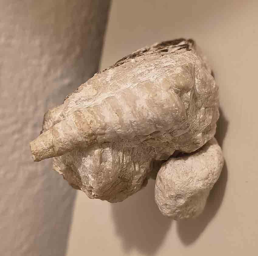
Rudists were bivalve molluscs that first appeared on Earth at the end of the Jurassic, about 160 million years ago, and spread widely during the Cretaceous. Unfortunately, as befell the dinosaurs and about 75% of extant species at the time, rudists disappeared definitively at the end of the Cretaceous (66 million years ago) in the last mass extinction.
Like modern oysters, rudists were filter-feeding organisms that populated the carbonate platforms of an ancient tropical sea. The name, introduced by Lamarck in 1819, derives from the Latin rudis (from which we get the English “rude”) for the rough appearance of their shells. Already by 1599 Ferrante Imperato had described their unusual shape, comparing them to “dragon horns”. Equipped with a robust shell, rudists were constructor organisms that possessed two valves which differed in shape: one fixed to the substrate and one mobile. They lived as solitary organisms or in colonies, filtering water to feed and reproducing through larvae transported by the currents.
Over the course of millions of years, rudists evolved into a range of species, assuming various forms and colonising multiple platform environments.
> The geo-palaeontological trail <
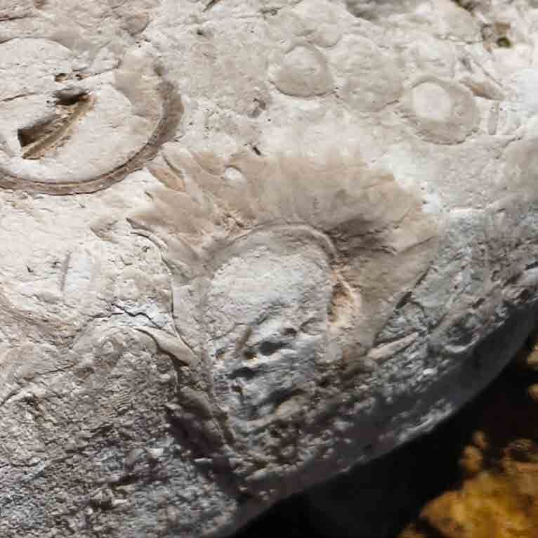
To promote the protection of geodiversity, a geo-palaeontological trail has been created that winds along a 6 km circular route, with a difference in altitude of 250 metres. The itinerary offers a varied experience with a part of the trail crossing the rocks and woods of the Cansiglio, while another opens onto large panoramic viewpoints, offering evocative vistas of the plain below. The route connects the two main mountain pastures of the Municipality of Polcenigo, the Malga Col dei S’cios and the Malga Costa Cervera, offering visitors not only an immersive experience in nature, but also an opportunity to learn about the local tradition of mountain summer grazing.
> The Friulian Platform <
The Cansiglio - Cavallo area, lying on the border between Veneto and Friuli Venezia Giulia, preserves traces of a distant past, dating back millions of years, when Italy and the Alps did not yet exist. Between the Jurassic and Cretaceous periods (from 200 to 66 million years ago), the current area covered by Friuli Venezia Giulia was a large marine carbonate platform, lying at the latitude of the tropics and called the Friulian Platform.
Set in the warm climate of the Mesozoic, the carbonate platforms played a predominant role in the entire marine landscape of the intertropical zones, creating landscapes similar to today’s Bahamas and favourable to the proliferation of life.
Over time, the resulting marine sediments were transformed into limestone rocks and the organisms into fossils.
In particular, the Col dei S’cios Limestone represents the base of the Monte Cavallo Formation and is indicative of one of the episodes of maximum development of rudist bioconstructions, which were established on the carbonate platform during the marine transgression phases (and during which sea levels rise) between 100 and 95 million years ago, the Lower and Middle Cenomanian.
Among the most representative fossils we find bivalve molluscs with numerous species of rudists of the Caprinidae family, among which Caprina schiosensis Boehm stands out and other less represented genera such as Apricardia and Radiolites. There are many gastropods of the families Nerineidae and Acteonellidae, while corals are sporadic.